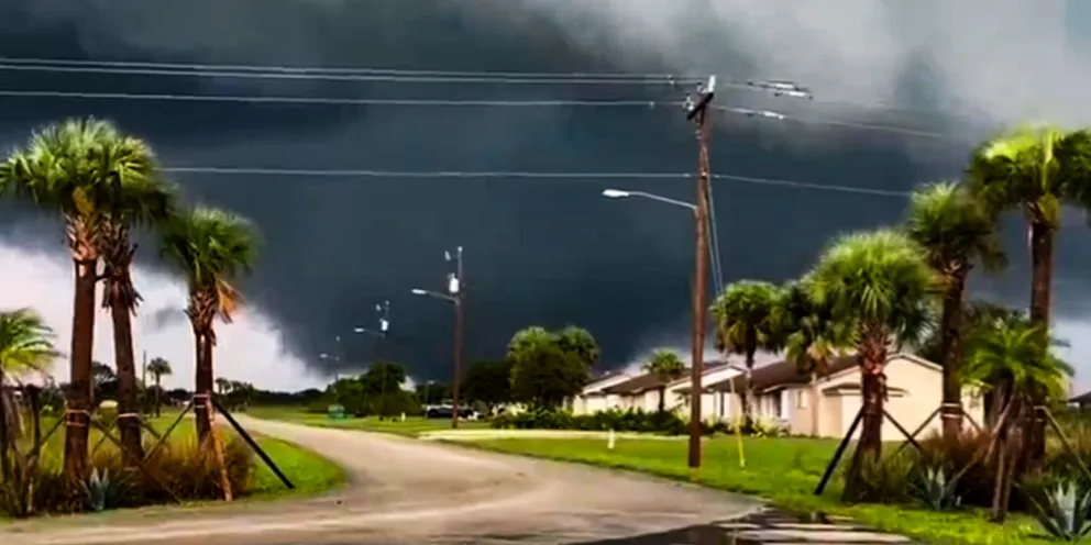
On the morning of October 9, South Florida came across with multiple tornadoes. The National Weather Service Miami-South Florida (NWS Miami) made an announcement and warned people for the Hurricane Milton is approaching.
People from Everglades, Big Cypress Seminole Indian Reservation spotted multiple tornadoes.
**Ongoing dangerous TORNADO on the ground **
SEEK SHELTER – SE Hendry County
Considerable Tag Issued! https://t.co/7n5bvGmip9
— NWS Miami (@NWSMiami) October 9, 2024
At 10:03 a.m. (EST), NWS Miami shared a warning from their X account, where they asked people to seek shelter if not left evacuated.
Later, they posted another picture with the caption, “Seek shelter NOW!”
Many people responded to the posts, as one netizen shared a video and wrote, “Outside Weston. Just took this,” where they were sharing their own spottings.
At 11:46 a.m. (EST) another meso-vortex tornado warning was made, on the western side of Lake Okeechobee near Lakeport.
“🚨 Storm Surge Threat Beginning🚨 Views from the Naples Pier this afternoon indicate that #Milton’s surge is beginning to arrive across coastal southwestern Florida with water levels steadily rising during what should be low tide Stay alert!”
At 4:20 p.m., they released another warning, “Given #Milton’s fast forward speed, the increase in water levels may be sudden. DO NOT DRIVE THROUGH SALTWATER!”
1:30pm Radar Update: A large convective band of Hurricane #Milton continues to rotate across southwestern Florida.
A new Tornado Warning is in effect 1:45pm for Collier and Hendry counties. pic.twitter.com/P2feOgw4Qj
— NWS Miami (@NWSMiami) October 9, 2024
At 5:13 p.m., NWS Miami shared that storm surge is rising and wrote, “PLEASE stay away from the Naples Pier and all beaches along the Gulf coast.”
At 5:24 p.m. (EST), the NWS wrote, “LARGE MULTI-VORTEX TORNADO REMAINS ON THE GROUND NOW MOVING INTO MARTIN COUNTY.”
And at 5:27 p.m., “DAMAGING LARGE TORNADO HAS NOW MOVED OUT OF PALM BEACH COUNTY.”
513PM: Gulf waters are rough with storm surge rising FAST. PLEASE stay away from the Naples Pier and all beaches along the Gulf coast. ⚠️⚠️ pic.twitter.com/7XXI3zvgfK
— NWS Miami (@NWSMiami) October 9, 2024
SEEK SHELTER IF YOU ARE IN THE AREA
What do you think? Let us know.
